
FR - Quick Terrain
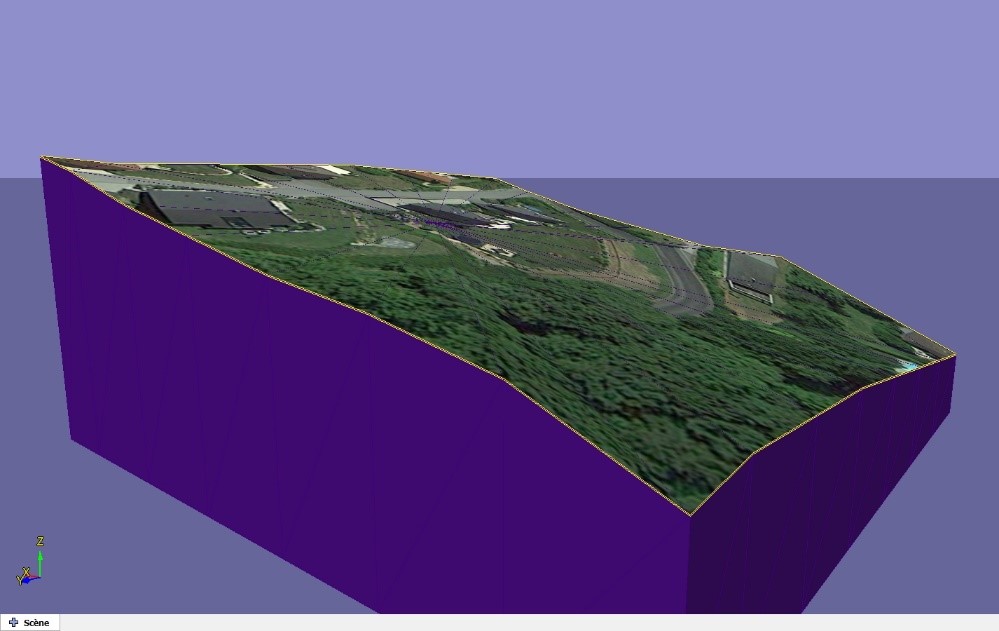
Generate a terrain without a surveyor and free is possible and it is called Cadwork Maps.
1 - Enter the terrain address
2 - Choose the resolution
3 - Click to integrate the terrain in Cadwork-Lexocad
For this all you need is an internet connection.
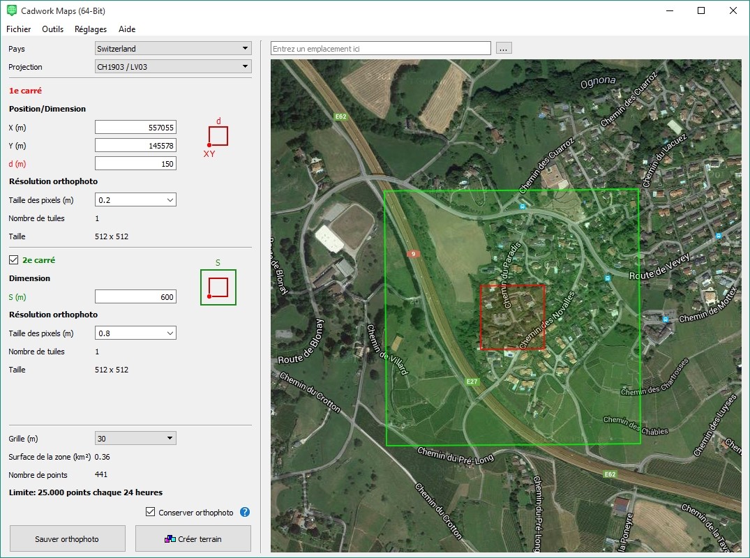
Cadwork Maps is free with the following limitation. You cannot download more than 25000 points per day from one IP address.
Based on the Maps API the precision is of 1 point per 15m which is sufficient for integration and quick calculations of cut and fill volumes. It is however insufficient for building permits.
Once the terrain is downloaded you can use the query tool or correct the triangulation with survey data (paid option) with the goal of producing a Cadwork model for a building permit.